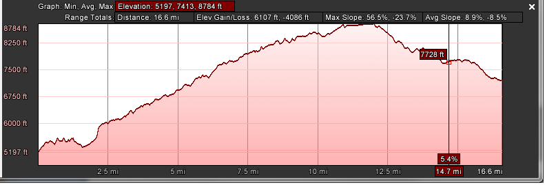
I don't get it. The data are a series of XML latitude and longitude points. The earth itself doesn't change based on the viewer used to see it (boy, that would be weird), so why would the elevation profile change between what is used to look at it? I guess there is no way to truly extract the accurate elevation profile information from any of the tools I have access to, considering there is a difference in Garmin's interpretation of their own data when the information is presented on their website as either a route or a course.
Google Earth: a reality distortion field. In this case, if I wanted my elevation profile to appear to be more of a challenge, I simply stretch the X-axis of the graph by increasing the width of the window and it happily accommodates me, making both the distance and the elevation changes appear greater on the screen. Selecting "Get Info"/"Properties" on the file in the places list and then selecting the Measurements tab shows the same for the length, so at least that seems to be static.
The data from the run is shown in the following images, with the screen grabs from the same kmz file. I wonder if it is simply a factor of revealing more information, thus making the wider view the more accurate view? I don't know, but I would be interested to find out.


 RSS Feed