EFPH - the end of the current route?
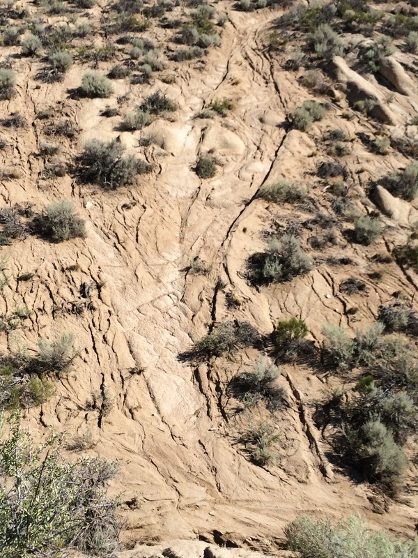
Seemingly, every trail that was a climb became a stream, and as a result, the dirt has washed away, leaving ankle-biter stones, sand and base rock. Any traversing trails are now cross-tracked/eroded by a myriad of streams. Those aren't really a cause for concern, since over the months between now and the races, the continued pounding of feet will mostly smooth them over.
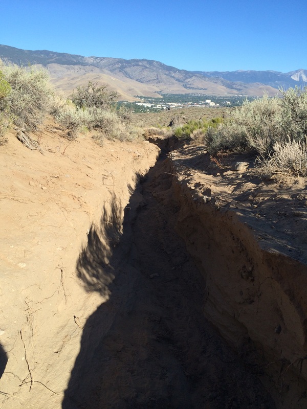
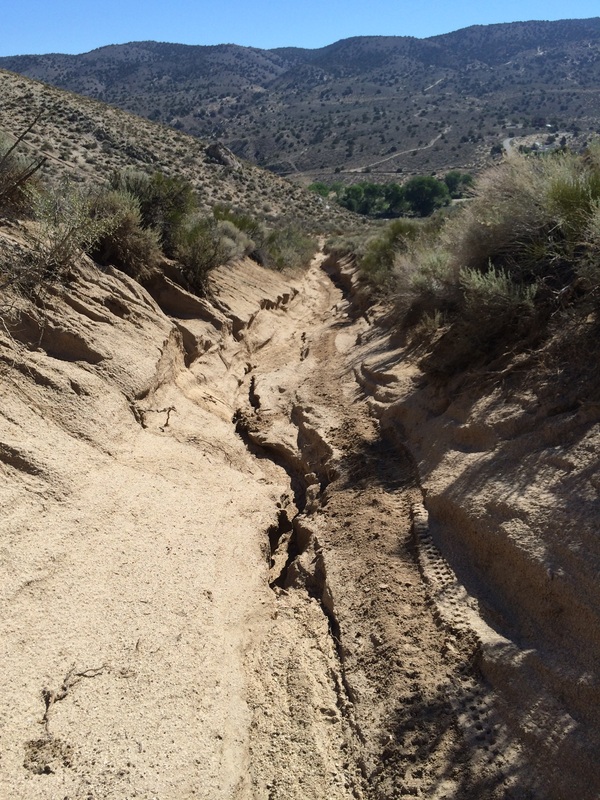
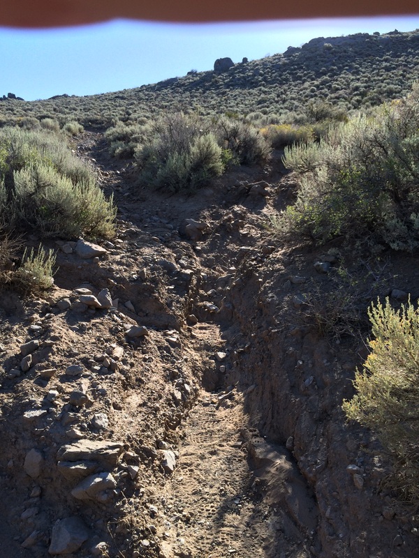
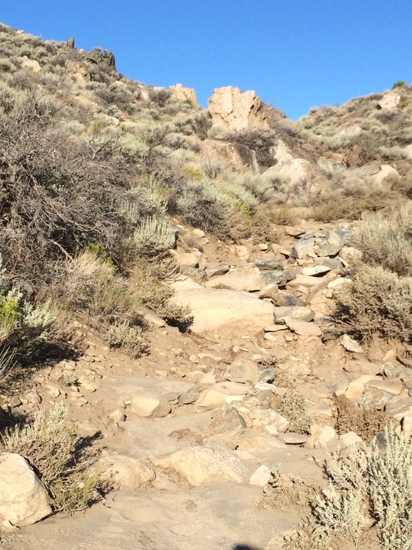
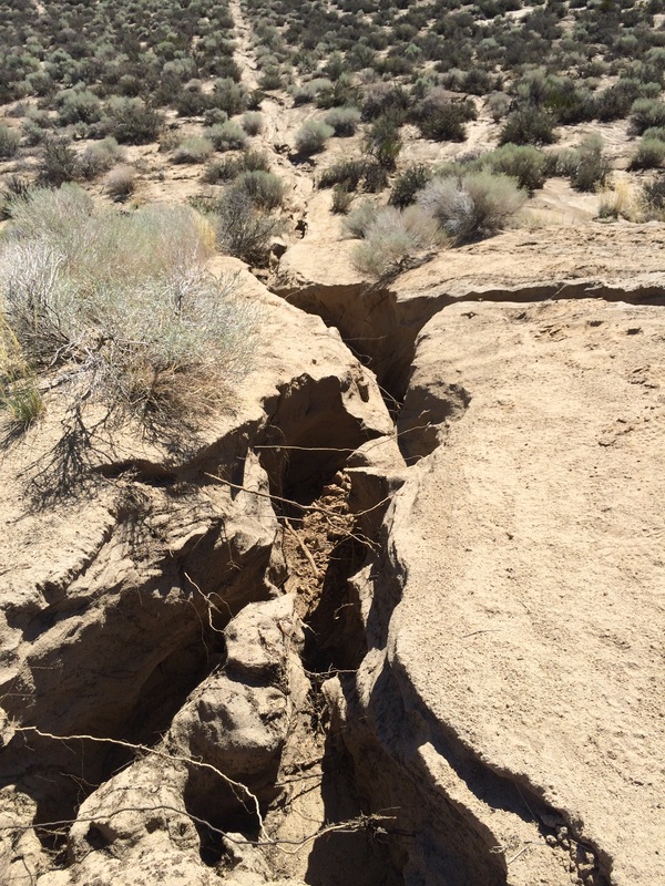
What is a concern is the condition of the climbs and drops. The photos don't do the damage justice, since the scale is not readily apparent:
| |
Dead Truck Canyon:
Lower DT is either rutted up to 18" or loose sand now. Unpleasant. It may get better with feet stomps.
Middle DT is a bit more difficult than before since the dirt has washed away leaving rocks. Typically this isn't a problem on uphills, but the descent is now a technical journey rather than a pretty speedy good time for the 10K.
Upper DT is washed out more than before and more technical.
Dinosaur Ridge Descent:
What was steep, and somewhat rocky is now equally steep and far more rocky and technical.
North Loop:
Not terrible, but the descent on the northwest is much more technical. The traverse along the east face has many, many stream crossings. These should smooth out.
Saddle to Koontz:
Probably will need to re-route around this section. 4' deep washout of a former "road" making a new arroyo. Not runnable, but slowly walkable.
Koontz to Snyder:
Not terribly destroyed, but the washouts made the trail much less visible. We'll need to mark it much better, since the route through the brush is not so obvious.
Snyder to South Climb:
The dirt road is fine. Some additional wash/sediment in the lower parts of the rolls, but no biggie.
South Climb:
Ugly as ever. It's more rutted, but who will really notice? It's not like anyone is approaching dangerous speeds on the up.
Top to River Descent (Including whoop-dee-dos):
Strong candidate for re-routing. The whoop-dee-dos always were steep and now have far less traction since the existing sand washed away.
River Descent:
Washed out up to 3' deeper with 18" steps. This used to be a fast, sandy, giant-stride type of drop. Don't think it will be again for a while until it smooths out. Any future rains will deepen the new arroyo.
River Jaunt:
Unchanged. Still a pleasant flat and fast trip.
The Insult:
What was a sandy climb to slap you in the face as you finished the race is now sandier, and with ruts. At the top, the "rut" is 6 feet deep.
Overall Analysis:
The course records are not in any danger of ever being broken. I think I will have to abandon the idea of the bounty on a new course record and will be forced to re-route. Since I have to re-permit the event this year, now is the time.
Anyone who holds a Strava Segment KOM/QOM can rest easy that their record will likely hold for a good long while.
Compression Socks - I think they might work!
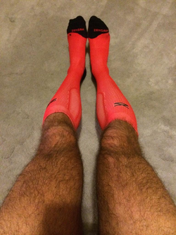 Look at them beauties! (The socks, of course.)
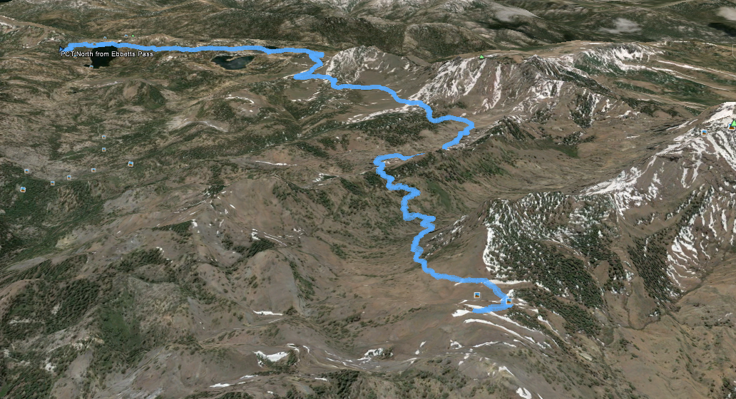
 I can't directly attribute the results to the socks, since I didn't do a proper experiment with controls (perhaps my nutrition & hydration was better too), but I am confident they were a contributing factor. I plan to use them as recovery socks after my next run Saturday on the PCT north of I-80 to see how they make the calves feel after a run. It should be a good test, since there are big climbs to happen there. I will wear low riders on the run, then afterward, switch to the compressions.


 RSS Feed