Slang's Anti-Singularity
  • Slanghome
  • Slangblog
  • Slangpuzzles
    • CurrentPuzzles
    • ScholarPuzzle
    • PastPuzzles

The ST Run

6/22/2012

0 Comments

 
Yesterday, I headed out for what turned out to be the "ST" run. I'll explain that in a minute. The run was a drop and go from Tahoe City to where I had left my car at the Bayview Campground across from Inspiration Point overlooking Emerald Bay on Lake Tahoe. The majority of the route followed the Tahoe Rim Trail and the Pacific Crest Trail, until it hit the Velma Lakes area, where I turned off, and headed east toward my car. 

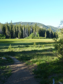
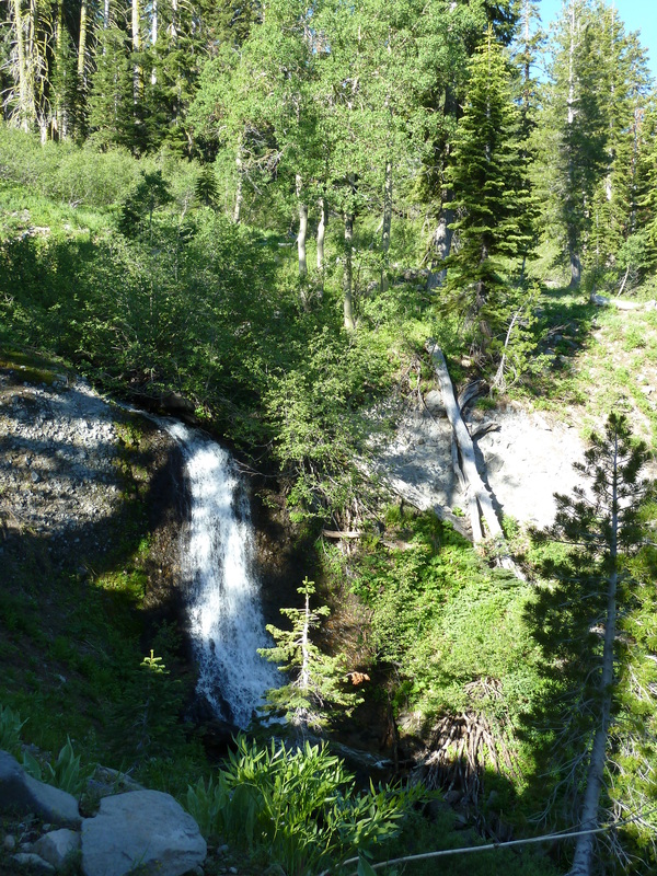
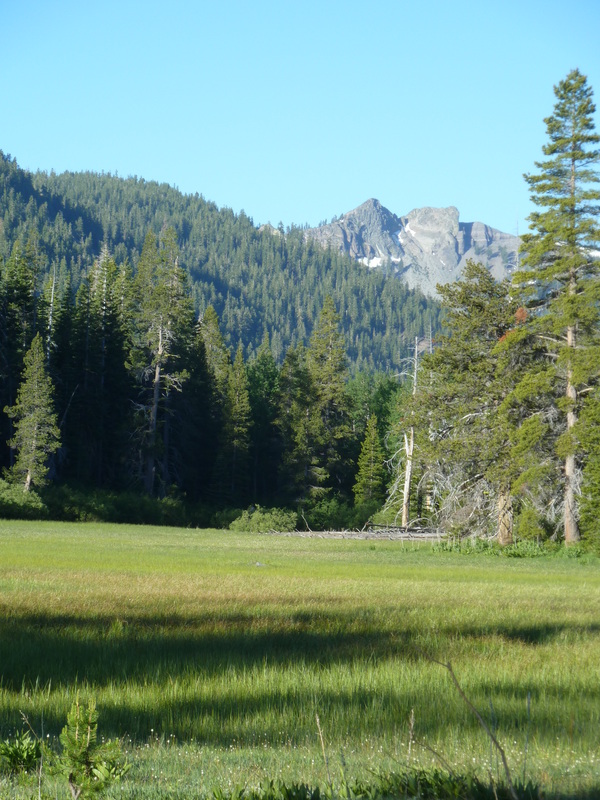
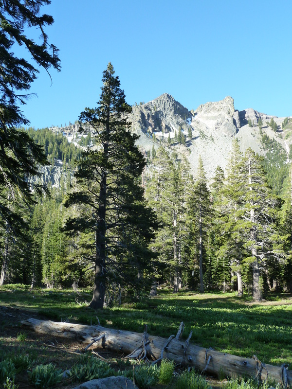
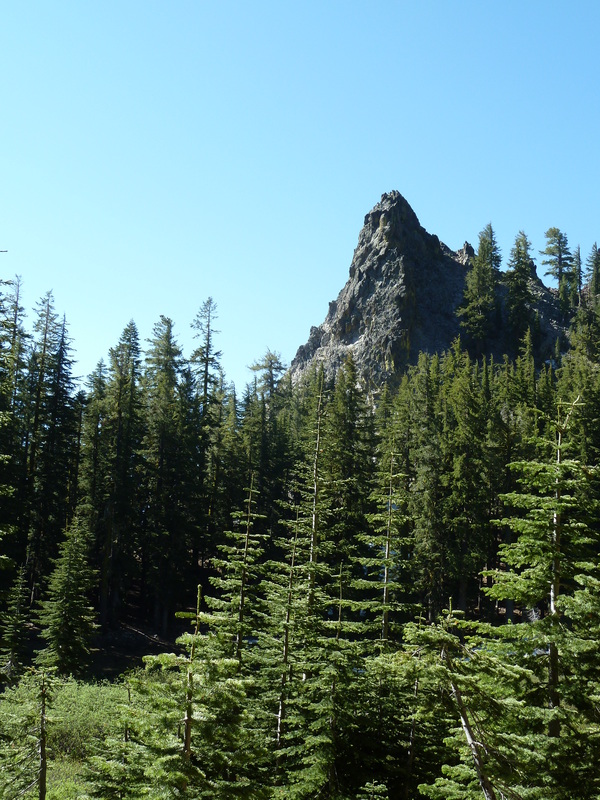
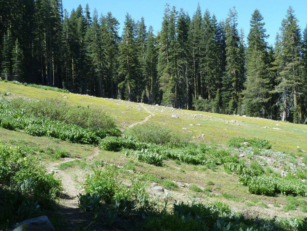
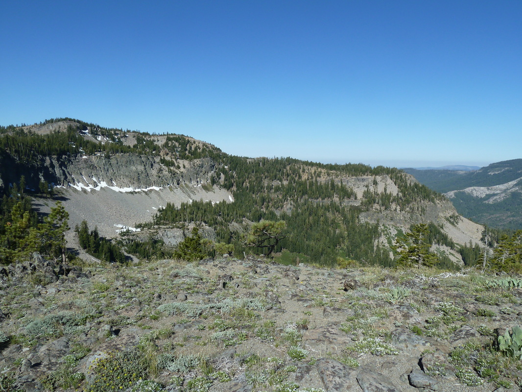
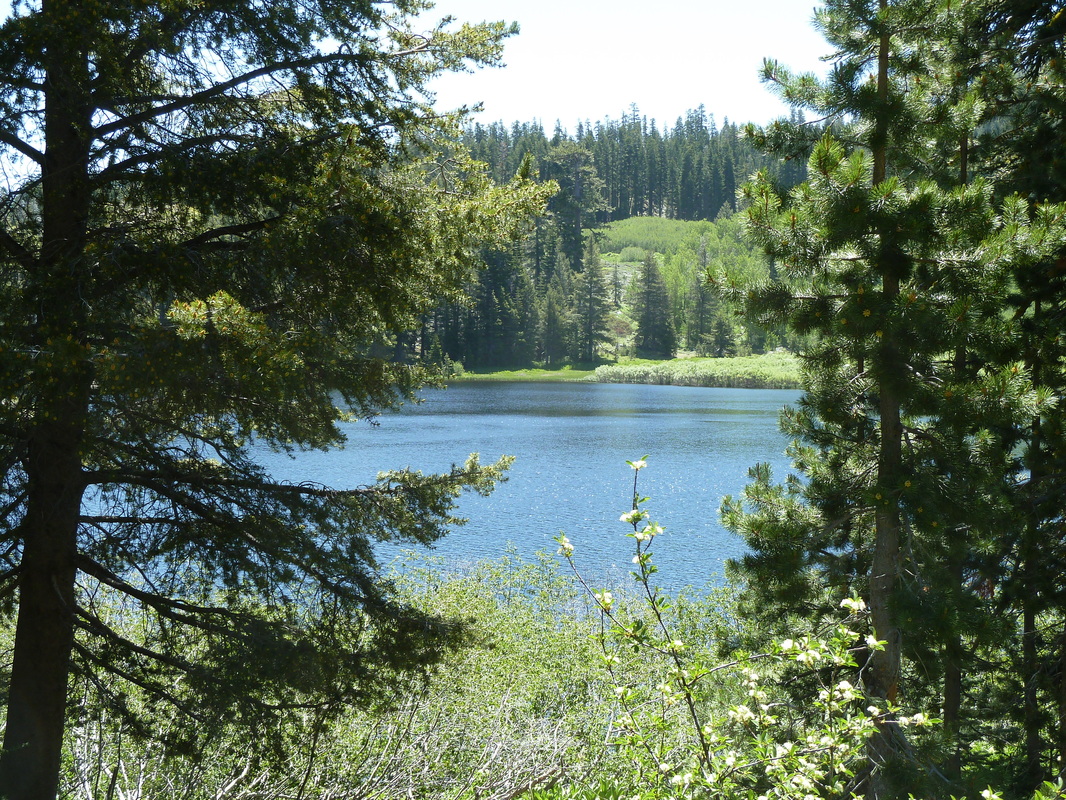
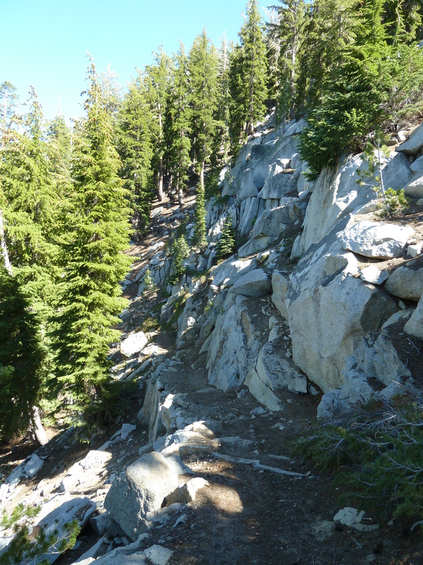
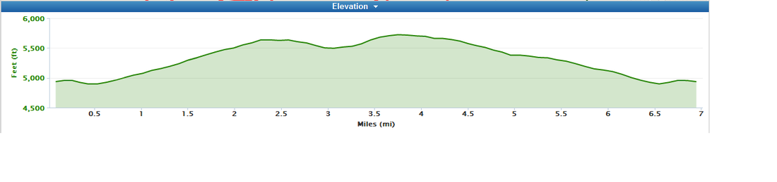
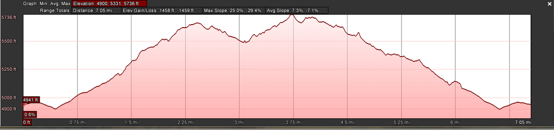
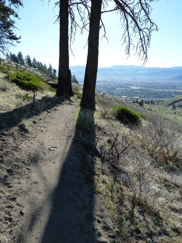
The views were tremendous, as you can see:
Picture
Picture
Picture
Picture
The run was the "st" run in many ways. 
  • the longest I had done with a pack;
  • the longest  I have done solo;
  • the longest  I have done unsupported;
  • the longest  I have done, period! 
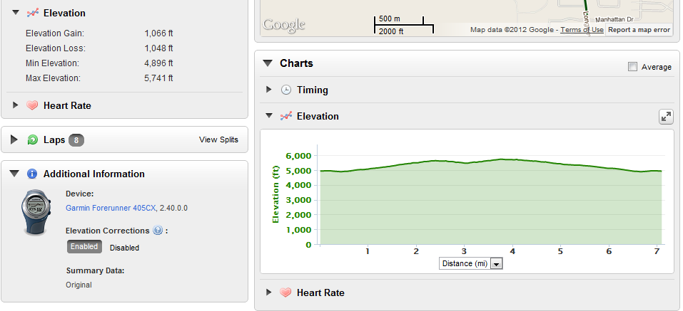
  • the most elevation gain (over 9000' according to Google Earth)

It was also the first run I have done where there really was no turning back. I had to finish, regardless. My car was at the end, and there was nothing at the start once I had left, since I had been dropped off. It was a mosquito-fest as well. Slowing to a walk served as an invitation to the little blood-suckers. Dozens would descend if I tried to stop for a stretch. I started to beg for the usual winds to blow them away.

I felt pretty damn good until I hit mile 25. There was this big wall there, and I smacked right into it. My stomach went sour, and even thinking of eating ANYTHING made me want to puke. Since I would have ralphed back up anything I put down almost immediately, I didn't see the point. As a result, my ability to run - shall we say - suffered? I ended up walking virtually all the last 12 miles. Water became an issue as well. I had 80 oz with me at the start, and none at the end. I even took a couple sips from a stream (I know, a no-no). And now, more pictures!
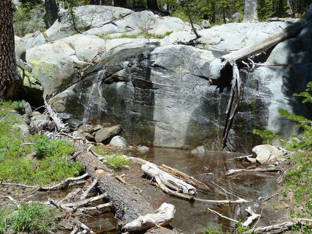
Picture
Picture
Picture
Picture
Picture
Richardson Lake
Picture
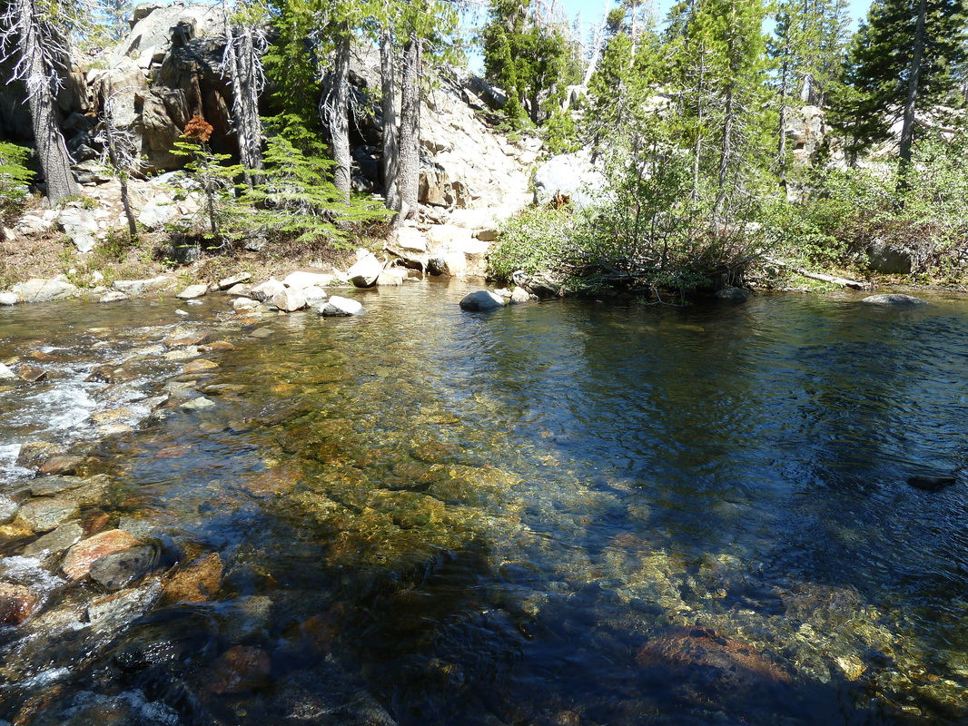
trail crossing - provided a chance to clean up!
All I can claim is that I completed the journey. The mileage might be off a bit, since the Garmin 405CX died at mile 31. Apparently, I am too slow and the battery failed at that point. The maps showed I was about 6 miles or so from the end where the Garmin died, so I calculated. It may be more, actually, since the maps to that point were about 10% off the GPS measured distances. I think the trail changes since it was mapped have something to do with it.

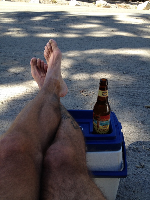
I met some nice people on the trail, and when one asked (it was "Caveman" I believe, who was hiking the entire PCT) why I was doing it, I quoted a Shin's song and said that I was trying to live a life less ordinary. At the time it made sense. When I was fighting the urge to empty my stomach every step of 12 miles, I could have done with a bit more ordinary. But the thought of what awaited me in the car, kept me going. The trail down to Bayview was steep, but pretty. The view of the beer was even prettier.
Picture
Picture
0 Comments

Moving Ahead With RunningAhead

6/8/2012

0 Comments

 
Run data, run data, run data. When will it EVER end? Probably with this post, is my guess. After this, well, I think I may stop harping about it, and simply enjoy the time outdoors and not worry about elevation profiles.

I recently started putting my run data on RunningAhead.com. I really like the site and the ability to graph multiple elements simultaneously on a single graph. I also like that it reads the data from my Garmin Forerunner 405CX wirelessly, too. That makes data upload easy. The only thing Garmin has on their site that I still occasionally look at is goal-progress. I imagine RA can implement that one pretty easily too, and eliminate any need for me to deal with Garmin.

When I uploaded some of my data, I noticed that, yet again, the elevation profile information was different from everyone else's. As part of a different conversation with Eric Yee from RunningAhead, I asked about why there were differences in elevation profiles for different sites. This is part of his response:

"It all depends on how the points are sampled.  The elevation data are sampled differently depending on location.  On RA, the entire country is sampled at every 30 meters.  Some parts of the country also have 10 meter samples.  The software will always choose the the highest resolution sample to use.

As you said in your blog, the points are expressed as a series of lat lng points.  Since the elevation sampling is in a grid, most of the points do not fall directly on the sampling point so some interpolation is needed.  This where where the difference between difference sites come from because each site will have a different interpolation algorithm.  Sites such as RA and Garmin tend to have reproducible elevation profiles (within each site) because all the servers use the same algorithm.

Google is different.  The reason you get a different profile depending on the computer you're using is that Google does a lot of things behind the scenes.  Depending on a bunch of factors such as your computer's geographic location, OS, and who knows what else, your request will be load balanced differently.  To make it more complicated, Google also do A/B test with their users so what you see will be different from what someone else is seeing.  Depending on which server is handling your request, it may have a different algorithm because it takes time for the software to be deployed across Google's network. "


Wow. Google is different. I also think there is a fudge factor at play on some of my runs in the data itself. If, for example I am following a trail on the side of a fairly steep hill, the trail may be in fact "flat" as it is following the contour. However, the GPS is not ever spot on, and it may be tracking a point 20 feet to the right, then 5 feet to the left, and so on. On a steep hillside, that 20' right might be 15 feet higher than I am, and the 5' to the left may be 10 feet down. So in the course of my movement of 10 feet straight ahead, and level, the GPS just might have tracked a 30' loss of elevation. Or so it seems to me.

At any rate, have a great weekend. My loin-fruit are free of school as of this afternoon, so they'll be as happy as I am tomorrow: they get to sleep in, and I get to go for a run before the big 13th birthday party for my son. O_O
0 Comments

Run data slicing and dicing

5/22/2012

0 Comments

 
When I run, I usually tote along my Garmin Forerunner 405CX in order to keep track of the miles trod, and to capture the information into courses and routes for others to (potentially) follow if it turns out to be a good one. Since not everyone uses Garmin products and may not want to use the Garmin website's courses feature, I also convert the GPS data to Google Earth and post all the information into a .kmz file (scroll to the download link) for viewing in Google Earth on a local pc.

The data is the same: XML data containing latitude and longitude and that's about it. When it gets to either the Garmin website and/or Google Earth, that data is interpreted over maps to give the user a visual look of the data rather than lat/long coordinates, and gives distance, and elevation profile. This is where it gets all divergent.

I did a run last Friday that I converted to a course. The base run data as uploaded is shown below (Sorry, you don't get to see my imminent heart attack displayed in the heart rate info, nor the "trudge factor" in the timing chart.):
Picture
When I elected to save the run as a course, the data changed! Instead of being over 7 miles, the course data was 6.95, though the elevation data remained the same with a gain of 1066 feet. However, I do like that the elevation profile no longer starts at sea level, making the 1000+ elevation gain almost look like it hurt as much as it did.
Picture
In addition to saving the run as a course, I used the Garmin function to export the data to a Google Earth file. This conversion results in yet another divergent data set. In this case, the run distance shows as 7.05 miles, which isn't too terribly off (only 1 %) from the base run data, but a big delta shows up in the elevation gain: 1458 feet. Wow. That's a 37% difference! I must admit I much prefer the look of a Google Earth elevation profile over either Garmin:
Picture
Just looking at the elevation profiles, I get the feeling that Garmin is smoothing the data that erases the small changes in elevation despite using Google as the mapping base. However, over the course of a longer run, the tiny smoothing changes the overall run a lot. Those three and five foot elevation changes on the trail add up. Tell me. Toward the end of a run, any little hill up -- only to go back down -- gets a sound round of cursing from me.
0 Comments

Spectabulous

4/23/2012

0 Comments

 
With apologies to The Drifters'  "Under the Boardwalk": 
Over the weekend, out in the sun.
Over the weekend, I had me some fun.
Over the weekend, I went running around.
Over the weekend, I watched soccer in town.
Over the weekend, weekend. 
Yes, I managed to mangle yet another old popular song  in my head as I finished up a run on Sunday. Saturday was spent at the soccer fields, as Mikaela had a soccer tournament. The weather was spectabulous with brilliant sunshine, and high temps in the low 80s each day. Great for Earth Day. 

Unfortunately, Mikaela's soccer team wasn't up to the level of the weather and lost all three of their games. It was hot, they got tired, but in the end, they simply didn't have it to win. On the bright side, I did manage to snap a few good action photos.
Picture
Picture
Quick Hits:
During the run, I had a couple of quick hitting items cross my mind. 

QH#1: The most serious is – in my mind – a glaring stupidity in the Garmin software for my FR405CX. For the last couple of runs, it's been deleting the oldest laps to make room for the new ones. That makes sense. Then, today, inexplicably, the timer stopped on a lap recording. The screen said I had to manually delete an activity for any new activities to be recorded. WTF? In the middle of a run (thankfully I don't race, and it wasn't in the middle of one), I have to stop, and manually slog through past activities and delete one for the timer to continue to record the current one. That. Is. Retarded. What's the first thing I did when I got home and uploaded my data? Deleted it all. I never refer to it on the wrist anyway. But still, forcing me to stop and delete an old activity to continue to time the current one is beyond the pale.

QH#2: I thought I would give a new-to-me nutrition method a go. I bought a tube of Perpetuem Solids sold by Hammer Nutrition a week or so ago and took them out for a run. I've never been a fan of goo-type running foods, and gummy cubes are just plain gross. Looking at the Perpetuem Solids, I'm reminded of Sweethearts - on steroids. Or giant Tums. I popped one in a was surprised by the lack of flavor. Maybe I've burned my taste buds out with my green chile, or the strawberry-vanilla was too subtle for me, but there really wasn't much flavor. Which in my mind, isn't necessarily a bad thing. The consistency is unusual, and took a bit of getting used to. But by the second one, I was firmly in favor of them for me. I like 'em, and will be using them on any future runs that require foods.

QH#3: After uploading my run to connect.garmin, (And deleting all of them on the wrist assembly - see above) I noticed that this run was the longest in 6 months, and my weekly total is the highest in 4 months. Nice. Maybe, just maybe I might be getting back into the swing. The elevation gain was a top 10, too. Must be the Perpetuem.
Picture
And a happy birthday to my bro who shares the celebration with our globe, though he came a bit before Earth day. 

That's it from the Slang weekend. Hope it was as good for you, doing whatever it is you do, as it was for me, doing what I do.  Do be do be do.
Monday Morning edit: I apparently missed seeing the fireball and concomitant booms while I was running in the early morning. I guess my breathing was so hard at that time (I would have been climbing the Ash Creek trail), I heard nothing. Bummer.
0 Comments

    RSS Feed

    Author

    Just a guy out exploring the world. Former world-class never-was endurance runner.

    ​Hit me up, and we'll catch a beer or coffee in your town.


    Follow @slang4201

    Archives

    August 2022
    July 2022
    June 2022
    May 2022
    April 2022
    March 2022
    February 2022
    January 2022
    December 2021
    November 2021
    October 2021
    September 2021
    August 2021
    May 2021
    October 2020
    September 2020
    December 2019
    November 2019
    October 2019
    July 2019
    October 2018
    September 2018
    May 2018
    April 2018
    November 2017
    October 2017
    July 2017
    June 2017
    June 2015
    August 2014
    January 2014
    October 2013
    September 2013
    June 2013
    May 2013
    April 2013
    March 2013
    February 2013
    January 2013
    December 2012
    November 2012
    October 2012
    September 2012
    August 2012
    July 2012
    June 2012
    May 2012
    April 2012
    March 2012
    February 2012
    January 2012
    December 2011
    November 2011
    October 2011
    August 2011
    March 2011
    October 2010
    July 2010
    January 2009
    December 2008
    October 2008

    Categories

    All
    2011
    Alfama
    Alternate Energy
    Android
    Angela Sullivan
    Animals
    Antiques
    Apple
    Ash Canyon
    Astronomy
    AT&T
    Australia 2022
    Bailout
    Battery
    Bicycling
    Biometrics
    Books
    Brisbane
    Cairns
    Canary Islands
    Carrier Iq
    Carson City
    Cascais
    Centennial
    C Hill
    C-Hill
    Christmas
    Climate
    Clothing
    Coding
    Colorado
    Columbus
    Cramps
    Curiosity
    Dad
    Dardanelles Lake
    Dell
    Dick's Lake
    Dilbert
    Diving
    Eagle Lake
    Earworms
    Eating Problems
    Eclipse
    Economy
    Ecuador
    Education
    Eldorado Canyon
    El Valle
    Energy
    Errors
    Espionage
    Europe 2019
    Evi
    Fallon
    Family
    Fontanillis Lake
    Food
    Gamboa
    Garmin
    Geocaching
    Goals
    Google
    Google Earth
    Grouse Lake
    Hiking
    Inov8
    Investing
    Ipad
    Iphone
    Iron Mountain
    Lanzarote
    Legislatures
    Lisbon
    Mac
    Market
    Market Drop
    Mars
    Mctarnahan
    Medicine
    Microsoft Word
    Motivation
    Mountain Biking
    Moving Minutes
    Music
    Nevada Day
    Nfc
    Ohio
    Olympics
    Openoffice
    Opportunity
    Panama 2018
    Panama 2022
    Paper Airplane
    People
    Playa Coronado
    Politics
    Portugal
    Prison Hill
    Privacy
    Puts
    Puzzles
    Quito
    Race
    Rant
    Reno
    Retrospective
    Roosevelt
    Running
    Running Dynamics
    Saddest Cities
    Safe & Sober
    Science
    Scuba
    Shoes
    Shopping
    Sicily
    Sierra
    Sierra Canyon
    Sintra
    Slangsploration
    Snl
    Soccer
    Software
    Spasms
    Spirit
    Sullivan Canyon
    Svn
    Tahoe
    Tahoe Rim Trail
    Taormina
    Taxes
    Technology
    Transit
    Travel
    Trees
    Vba
    Velma Lakes
    Venus
    Verizon
    Violin
    Watches
    Weather
    Wolframalpha
    Words
    Wrestling
    Writing
    Xkcd
    Yawbe
    Yoga

This is ALL MINE, I tell you! copyright 2010-2022