I was fortunate enough to get Veteran's Day as a day of work-hooky, so I took advantage of the opportunity to seek out new trails and to boldly "run" where no slang has "run" before. (Yes the word is in quotes. If you saw how I move, you'd put it in quotes, too.) For this journey, I headed east from Carson City, through Dayton out to the burgeoning megalopolis of Stagecoach, NV. Out there is a trail or two I dimly recalled from a mountain bike escapade many years ago, where I tagged and toiled along with Jeff Potter (who created the trail) and some other serious mountain cyclists.
I've always liked running a "Potter Bike Trail." Why? Because he makes such damn good trails. I also don't mind running a typical bike trail as the tires tend to smooth it out and when it's soft, I get to mash down bike corduroy. Works out for all, as far as I'm concerned.
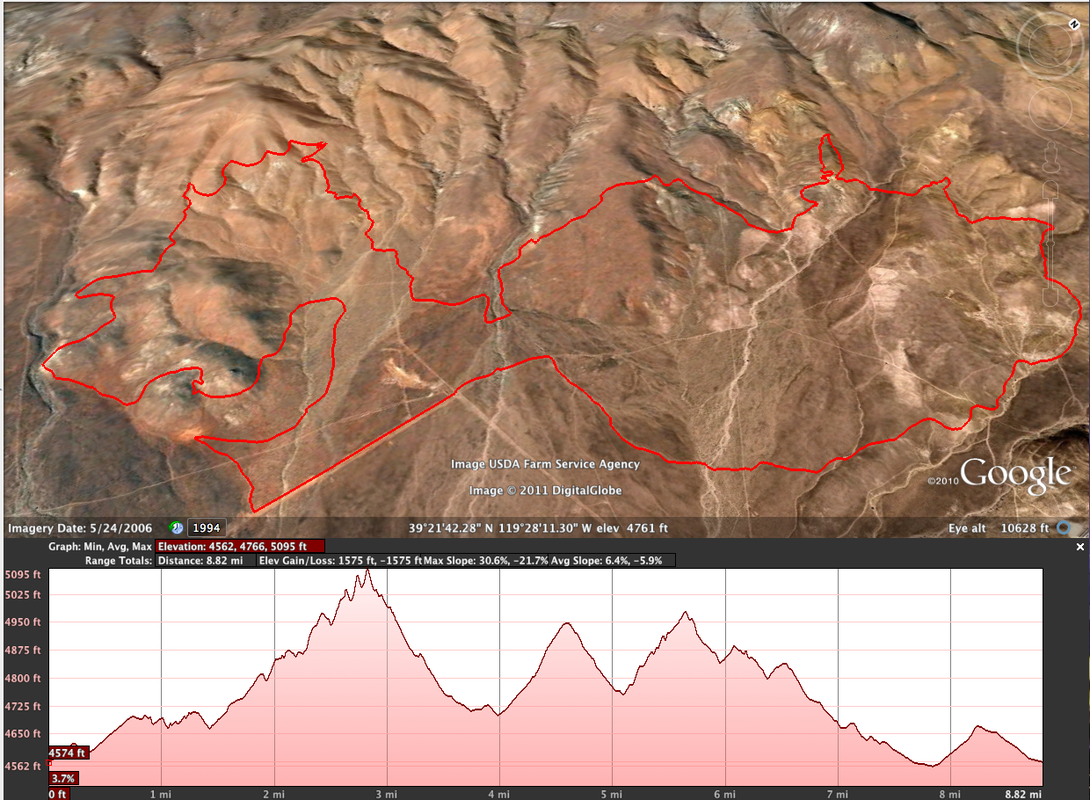
To find the location, I sneaked a peek at a mountain bike website to get an image of the trail, printed it and used it as a map. I had to do some sleuthing on The Goog to determine the start location. Having the "map" worked out pretty well, as I only missed a few turns and added only about 1/2 mile overall. After cleaning the mistaken turns and mapping it cleanly, it shows a 8.97 mile route. I'll call it 9. Any arguments? I didn't think so.
(As an aside, there is a discrepancy on Google Earth for a route when the distance is shown using "Get Info" and when the distance is shown on the Elevation Profile. I don't know why, but on this particular journey, GI =8.97, and EP= 8.82.)
Below is a GE screen shot showing the route and elevation profile. The Lat/Long displayed is the start location, if you want to give the route a go yourself.
I've always liked running a "Potter Bike Trail." Why? Because he makes such damn good trails. I also don't mind running a typical bike trail as the tires tend to smooth it out and when it's soft, I get to mash down bike corduroy. Works out for all, as far as I'm concerned.
To find the location, I sneaked a peek at a mountain bike website to get an image of the trail, printed it and used it as a map. I had to do some sleuthing on The Goog to determine the start location. Having the "map" worked out pretty well, as I only missed a few turns and added only about 1/2 mile overall. After cleaning the mistaken turns and mapping it cleanly, it shows a 8.97 mile route. I'll call it 9. Any arguments? I didn't think so.
(As an aside, there is a discrepancy on Google Earth for a route when the distance is shown using "Get Info" and when the distance is shown on the Elevation Profile. I don't know why, but on this particular journey, GI =8.97, and EP= 8.82.)
Below is a GE screen shot showing the route and elevation profile. The Lat/Long displayed is the start location, if you want to give the route a go yourself.
The day was cloudy and cool, with a slight breeze - just enough to get the snot flowing and the sweat chilling as the four of us traveled along (I was alone, though the usual companions I run with were in attendance: Bad Form, Constant Pain and Fear of Failure). I didn't see another living creature the entire 2 hours. No squirrels, snakes or insects. Nary a bird - not even a circling vulture or two for effect. And the gray skies increased the overall mood of isolation and aloneness. It was awesome!
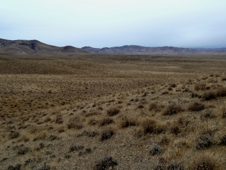

This part of the trail was heavily forested (relatively). I just had to hope my Garmin would continue to receive a signal through the heavy canopy.

 RSS Feed