Yesterday—being the official Nevada Day holiday, and having the weather perfect — the high Sierra called to me, "Hey, dude. It's me, the Sierra? It's been 6 days - don't you love me any more?"
Being the nice guy that I am, I immediately accepted the invitation, packed up and headed out. I wanted to try a new trail I had discovered on a map. The trailhead is on South Upper Truckee Road, off the west side of Luther pass at 38°47'45.19", 120°01'05.17" I wasn't sure what I would find, and feverently hoped that the road to the trailhead was paved. My beater 4Runner was in the shop over the weekend getting tuned and worked on, and I had to drive the nice car. It's not something I would have taken last week to Blue Lakes on my journey to Grouse Lake, as that road isn't the best between Lower and Upper Blue Lake.
The weather was perfect: temps in the high 40s at the start and a touch over 60 when I finished. No wind, no clouds - just a spectacular blue sky! A complete photo set for this trip is on Flickr, here.
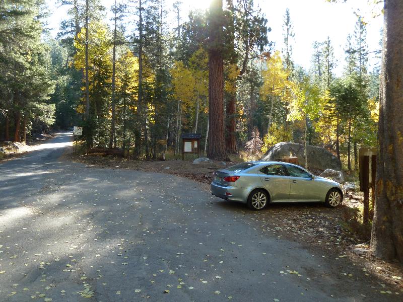
I had the trailhead to myself when I started:
Being the nice guy that I am, I immediately accepted the invitation, packed up and headed out. I wanted to try a new trail I had discovered on a map. The trailhead is on South Upper Truckee Road, off the west side of Luther pass at 38°47'45.19", 120°01'05.17" I wasn't sure what I would find, and feverently hoped that the road to the trailhead was paved. My beater 4Runner was in the shop over the weekend getting tuned and worked on, and I had to drive the nice car. It's not something I would have taken last week to Blue Lakes on my journey to Grouse Lake, as that road isn't the best between Lower and Upper Blue Lake.
The weather was perfect: temps in the high 40s at the start and a touch over 60 when I finished. No wind, no clouds - just a spectacular blue sky! A complete photo set for this trip is on Flickr, here.
I had the trailhead to myself when I started:
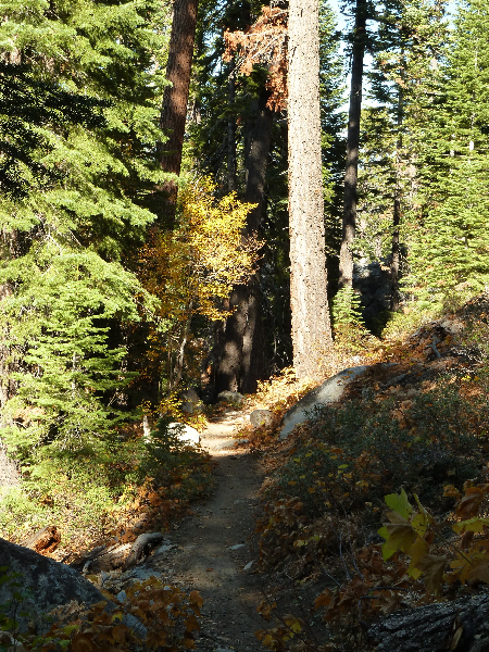
The trail was in great shape, and the trees would make this a great shaded summer run. The only tracks I saw in the dirt as I toiled my carcass up the trail were bicycle tracks. It appears that this particular trail is a well-cycled one.
There were many switchbacks along the trail, which is possibly why the map indicated 2.8 miles to the junction to Dardanelles Lake, and my Garmin registered 4 before I saw any trail junction. The junction is NOT marked, though if you continue up the trail past the junction (as I did to verify) the TRT junction (well marked) is only .25 miles further up. That confirmed to me that the unmarked one was indeed the trail to Dardanelles Lake.
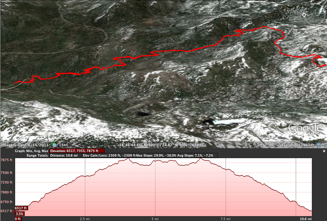
Below is a screen capture of the Google Earth view of the trail and the elevation profile. You can see the switchbacks along the route.
Below is a screen capture of the Google Earth view of the trail and the elevation profile. You can see the switchbacks along the route.
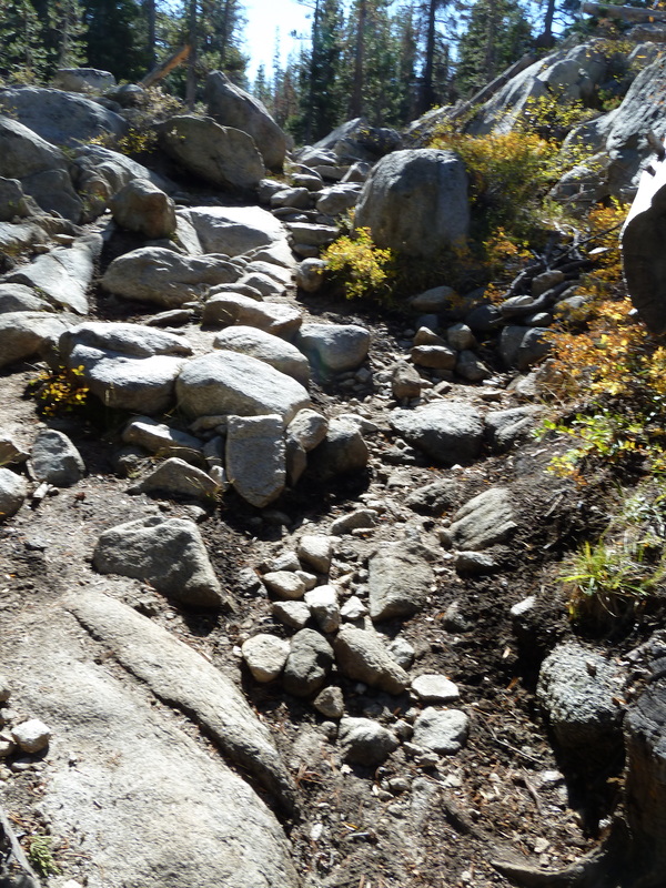
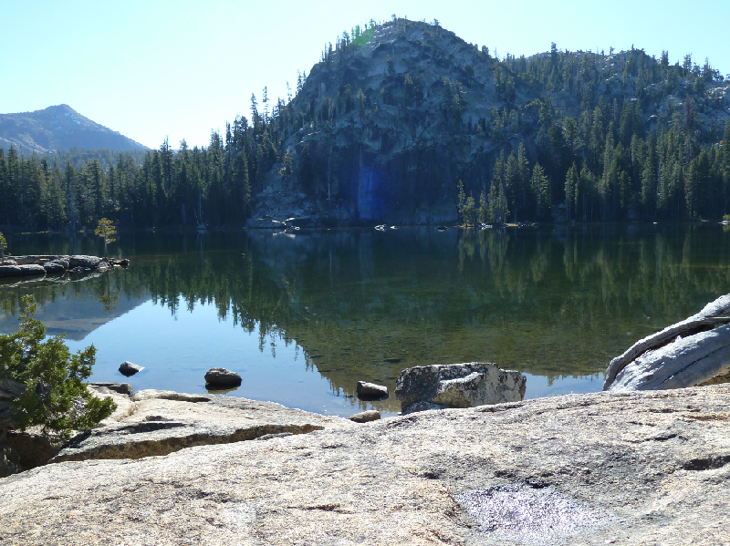
The smooth trail eventually gave way to a rocky course, that I would guess doubles as a stream bed in high water seasons. Though rocky and challenging, this part of the trail was really short, and right at the end. At the top there, was the lake.

I finally encountered my first human while on the return trip. At the junction to Dardenelles, I met up with three people on horseback. Apparently, I wasn't the only person who decided to play hooky on a beautiful late October day.
Overall, I was really happy with the journey. It was the first time I have been able to run the entire course of a planned route in about 4 months. Injuries that have kept me down seem to be disappearing, though the standard pains are always with me.
Overall, I was really happy with the journey. It was the first time I have been able to run the entire course of a planned route in about 4 months. Injuries that have kept me down seem to be disappearing, though the standard pains are always with me.
 RSS Feed